Most people have heard of the splendor that awaits in Rocky Mountain National Park, but what many don’t know is the Denver region offers a bounty of beautiful trails with endless possibilities for hiking, biking, and walking. From urban trails and bike paths to gorgeous red rock formations under 60 minutes from downtown, take advantage of these amazing hikes just a short drive from Denver, Colorado.
Fun Fact: Many of these trails are projects the Flood Control District has spearheaded or contributed. So, we’ve peppered in some opinions from our staff members on what makes the trails so great. Enjoy!
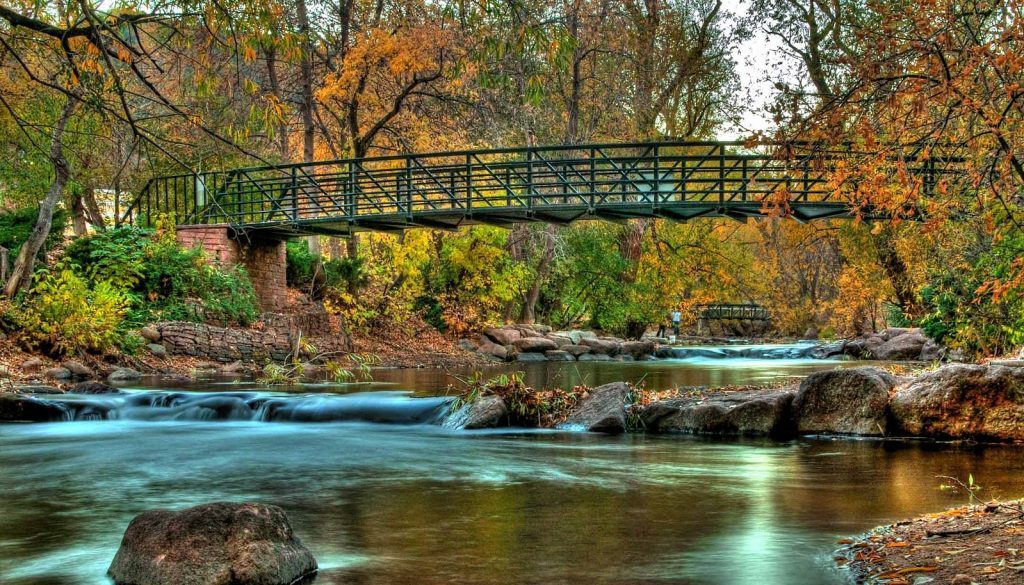
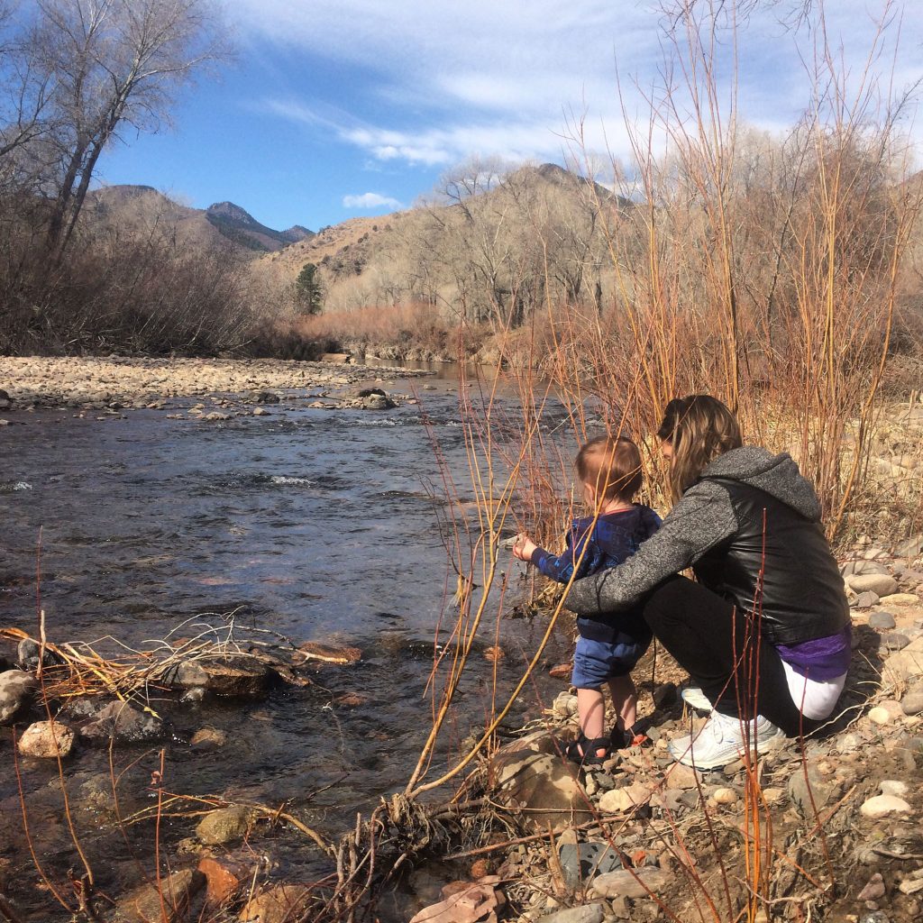
1. Boulder Creek
40 minutes from Denver
7-8 miles round trip
Out and back path
Elevation gain: 559 feet
Difficulty: Easy
If you’re looking for a beautiful, family-friendly hiking trail in the Front Range, look no further than the Boulder Creek Path. This moderately trafficked, partially paved trail follows the wandering Boulder Creek all the way from the eastern part of Boulder to the base of Fourmile Canyon. Along the way you’ll have views of impressive rock faces along the canyon walls, while also weaving through plenty of community parks and the University of Colorado campus. Although you can access the Boulder Creek Path from many areas in the city, the trail also runs straight through Eben G. Fine Park, which is a popular and convenient location to start your hike.
Photo courtesy of Wikimedia contributor, Kevin (User:G6489)
“My favorite is the Boulder Creek path in the area of Broadway Street in the City of Boulder. I like the trail in this area due to the usage that it gets, the activities in the area, and the people watching (Boulder is great for people watching). The trail system in Boulder is more of a transportation system than a recreational system. It is inspiring to see how many people are using this trail to commute throughout the city. I think more places should aim for a trail system that functions this way. This trail also routes people to the library, municipal buildings, and area parks. As a drainage nerd, I like the flooding education that is in the area. The Gilbert F. White Memorial Flood Marker is just downstream of Broadway. Many consider Mr. White to be the father of floodplain management. The silver bands on this marker indicate the depths for the 50-year, 100-year, 500-year floods, and what the Colorado Big Thompson flooding depth would have looked like in Boulder. These flood level markers provide some context of flooding to the general public.” — Jim Watt, Project Manager | Watershed Services
2. Deer Creek Canyon Park
40 minutes from Denver
2.7 miles round trip
Loop path
Elevation gain: 500+ feet
Difficulty: Easy
There are many hiking trails to choose from in Deer Creek Canyon Park, (including Meadowlark, Homesteader, and Golden Eagle Trails) but our favorite is the 2.7 mile loop that combines two of these trails together. Perfect for all ages, this hike takes you 1.6 miles on the Meadowlark Trail until you reach the Plymouth Creek Trail junction. From here you turn left on Plymouth Creek Trail for just over one mile, and you’ll be back at the original trailhead you started from. Another fun perk is the Deer Creek Canyon Trailhead has ample parking and is easily accessible, making it a great hike near Denver to try out.
Photo courtesy of Jefferson County government.
“My all-time favorite trail is Deer Creek Canyon Park, a JeffCo Open Space trail system. I like this trail because it is very accessible and has great views of the valley. The park offers a lot of trail options. Go for a short hike or extend it into an all-day outing. You can easily create a loop hike when you incorporate the hiker-only trail off of the parking lot.”—Teresa L. Patterson, Project Manager | Watershed Services
Deer Creek Canyon also offers mountain biking. More info here.
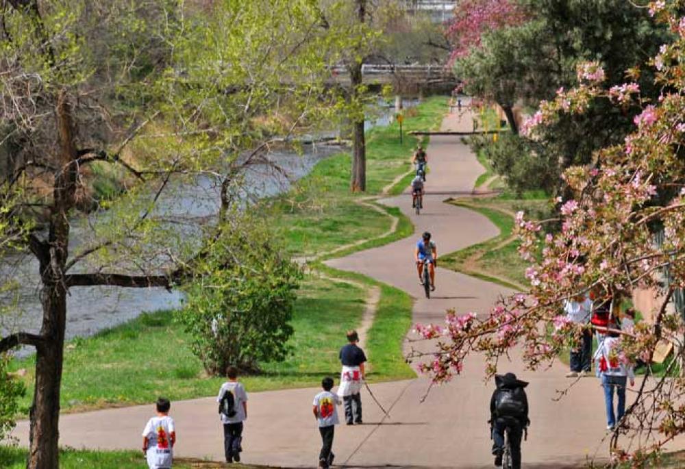
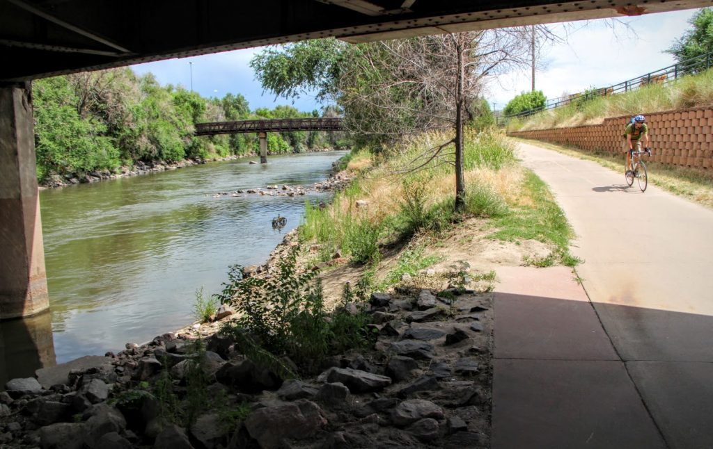
3. Cherry Creek Trail
0 minutes from Denver
40 miles out and back trail
Elevation gain: 450+ feet
Difficulty: Easy
Despite being in the heart of the city, the Cherry Creek Trail remains one of the best hikes in Denver, Colorado. Running for 40 miles, the multi-use Cherry Creek Trail starts at the Platte River Trail at Confluence Park in Denver and goes all the way to south of SR 86 in Franktown. Considered a bike thoroughfare — but perfect for walkers, joggers, and even dogs (as long as they stay on leash) — the Cherry Creek Trail offers a sanctuary from the busy streets above. What’s more, this trail is easily accessible from many different roads and parks in and near Denver, like Sunken Gardens, Alamo Placita Park, and Four Mile Historic Park, and even runs all the way around Cherry Creek Reservoir.
Photo courtesy of Colorado.com.
“I love the trail because of the proximity to my house, shopping, Cherry Creek, social trails, parks, downtown, and my work.” — Jason Stawski, Senior Construction Manager | Operations and Development
4. High Line Canal
35 minutes from Denver
71 miles point to point
Elevation gain: 593 ft
Difficulty: Moderate
When you take a ride (or walk) on the High Line Canal, you’ll be on one of the longest consecutive hikes near Denver, and one of America’s longest urban trails. Located in Littleton, Colorado, the High Line Canal is 142 miles round trip (out and back) and was originally designed as an irrigation stream in the 1800s. With much of the trail being shaded by Cottonwood trees, the High Line Canal path follows the contours of the land, making it an interesting and beautiful bike, jog, or walk.
“Lose yourself on the 71-mile trail that parallels this 135-year-old canal—you’ll forget you’re in the city.” — Ken Mackenzie, Executive Director
5. Lee Gulch Trail
30 minutes from Denver
8.1 miles point to point
Elevation gain: 340+ feet
Difficulty: Easy to Moderate
In total, the Lee Gulch Trail runs for 8.1 miles but one of our favorite sections of the hike is the 4.5 mile stretch starting at the Lee Gulch Overlook and ending at Horseshoe Park, both in Littleton Colorado. Along this trail you’ll travel through many different parks, enjoy the view of the river, and even pass by the lake at Ashbaugh Park.
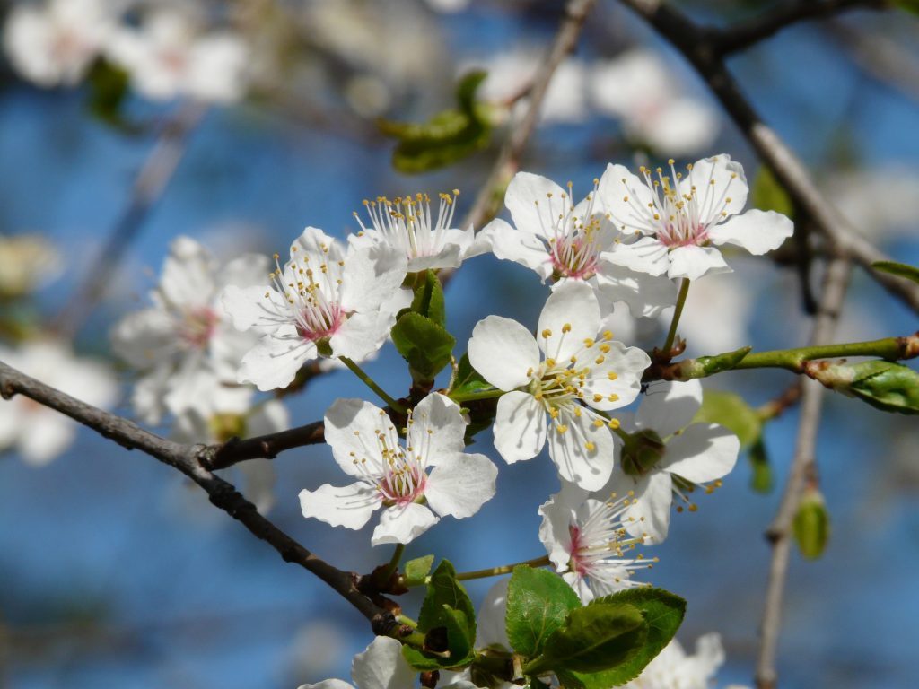
Here is the Prunus Americana in its flowered form. It’s also known as native plums, which can be eaten in fruit form, and were widely consumed by American Indians and early settlers.
“Lee Gulch Trail is the historic home of an ancient Indian camp site at its confluence with the South Platte River to near Broadway where the High Line Canal crosses in a historic overhead flume. Stop and enjoy the plentiful native plums (Prunus americana) that grow along this urban treasure in the summertime.”— Ken Mackenzie, Executive Director
6. Waterton Canyon Trail
60 minutes from Denver
12.4 miles point to point
Elevation gain: 700+ feet
Difficulty: Easy to Moderate
From hiking to horseback riding, mountain biking or fishing, you can do it all along the Waterton Canyon Trail. But unlike most hikes near Denver, one of the biggest perks here is the wildlife you might encounter, including the famed Rocky Mountain bighorn sheep. Additionally, there are many different options for distances to choose from, such as the 3-mile round trip hike to the Waterton Canyon Picnic Area or the full 12.4 miles down to the Strontia Springs Dam.
Waterton Canyon provides great access to the Colorado Trail. It’s also a hotspot for seeing wildlife, including bighorn sheep. Parking is plentiful even on weekends as the trail is not heavily trafficked.
“I love the trail because the outdoor activities in the area and off the beaten path access to the South Platte River.”— Jason Stawski, Senior Construction Manager | Operations and Development
7. South Platte River Trail
0 minutes from Denver
36+ miles point to point
Elevation gain: 98 feet
Difficulty: Easy to Moderate
Get the best views of the city of Denver and the surrounding area all on one trail. At over 36 miles long, the South Platte Trail winds its way from along the river through urban Denver before stretching its way to the plains. Plus, once you break out of the concrete jungle, you’ll be rewarded with views of the Rocky Mountains, which serve as the backdrop for much of the trail after you leave the city.
Photo courtesy of Spinlister.
8. Carson Nature Center in Littleton
30 minutes from Denver
8 miles
Elevation gain: 33 feet
Difficulty: Easy
The beautiful Carson Nature Center not only provides access to the Mary Carter Greenway Trail, (which runs through the park along the South Platte River for 8 miles) but boasts over 880 acres of open space for you to explore. After you’re done hiking the trail, make sure to check out (or fish!) at the five different lakes and even use the interactive River Table at the Center to learn about the famous flood of 1965.
“My personal favorite are the social trails or fishermen trails that are adjacent to the South Platte River near the South Platte Park Carson Nature Center in Littleton. I like this area because the Carson Nature Center has a river table that allows kids to get their hands dirty and to see how rivers and flooding works — then you can take a walk down by the river and see the river in real life. My kids love the trails, love getting down by the river and throwing rocks, and the trail seems very secluded.” — Jim Watt, Project Manager | Watershed Services
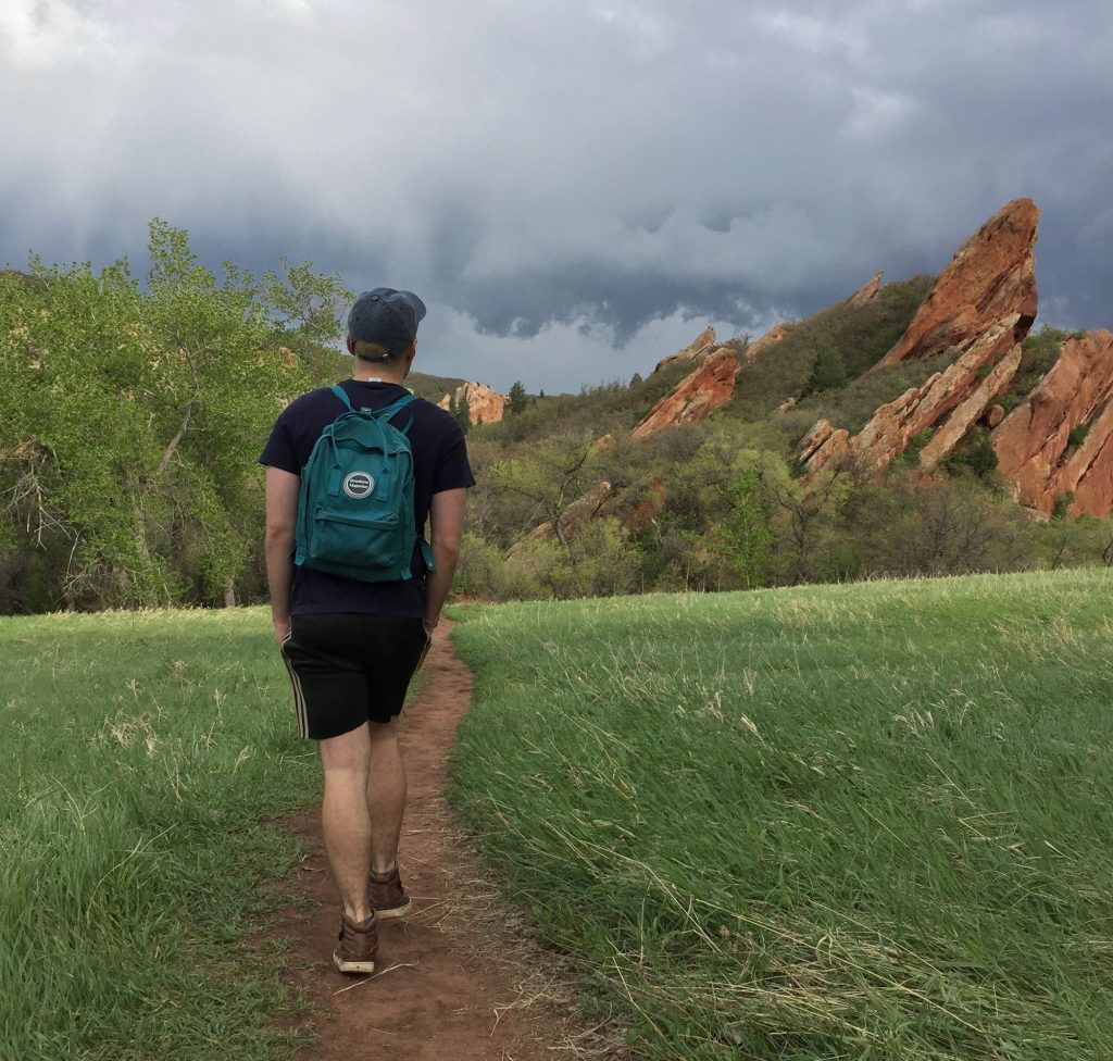
9. Roxborough State Park
35 minutes from Denver
14 miles total
Elevation gain: Varied
Difficulty: Moderate
Even if you’re not looking to drive south of Denver to Colorado Springs to hike Garden of the Gods, you can still see gorgeous, dramatic red rock formations at Roxborough State Park. With eight trails (and 14 miles) to choose from, you’ll be able to take in the views of Red Rocks Amphitheater in the distance or panoramic views of the city of Denver.
Roxborough State Park is very similar to Red Rocks but with one major difference. Roxborough has considerably less traffic and tourists. Getting into the state park can take about 20 minutes sometimes because they limit the amount of traffic allowed in at one time. But, overall it’s worth it. The rock structures are just as dramatic — if not more stunning — than Red Rocks. Hiking trails stretch as long as 9 miles and vary in intensity and duration.
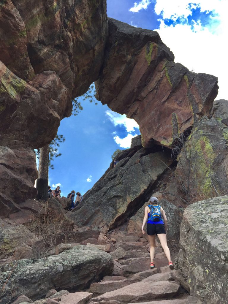
10. Royal Arch
40 minutes from Denver
3.5 miles out and back
Elevation gain: 1400+ feet
Difficulty: Hard
Looking for a challenge? Head out for one of the best hikes in Boulder that will take you past the famous Flatirons, and deep into Chautauqua Park. Even though this hike is on the shorter side, it’s not for the faint of heart and is definitely a serious workout. On the trail you will be ascending and descending alongside the mountain until you emerge at Royal Arch — a stunning and giant rock formation nestled on the mount side forest — and definitely worth the climb.
Map of locations in this post
—-
These 10 trails are just a taste of what the Denver region offers. What did we forget? Like what you saw?
This website uses cookies so that we can provide you with the best user experience possible. Cookie information is stored in your browser and performs functions such as recognising you when you return to our website and helping our team to understand which sections of the website you find most interesting and useful.
Strictly Necessary Cookies
Strictly Necessary Cookie should be enabled at all times so that we can save your preferences for cookie settings.
If you disable this cookie, we will not be able to save your preferences. This means that every time you visit this website you will need to enable or disable cookies again.
3rd Party Cookies
This website uses Google Analytics to collect anonymous information such as the number of visitors to the site, and the most popular pages.
Keeping this cookie enabled helps us to improve our website.
Please enable Strictly Necessary Cookies first so that we can save your preferences!