How Environmental Regulation Has Helped Produce Better Linear Infrastructure Designs
Written by Mary Powell and David Skuodas from the Mile High Flood District
Observing the similarities between highways and floodways when it comes to infrastructure design is both interesting and educational. How are they alike? They’re both long and linear and cross through many topographic features as they convey a flow of cars or water, for starters. Thanks to the advancement of science and technology the design approach to these long linear infrastructure projects has evolved. However, much of the positive change can also be credited to environmental regulations, which have been a major driving force behind more inclusive decision-making processes. Decision making processes identify which variables or disciplines will even be considered in determining what a successful project will be.
Let’s look at some examples to illustrate this point.
If you’ve ever visited Colorado, you probably headed into the mountains — which means you probably drove on Interstate 70 (I-70). As you drive west along I-70 from Denver you pass over and through several prominent natural features, such as Loveland Pass, Vail Pass, and Glenwood Canyon.
A fascinating note: The highway designs at these features are a visual representation of the influence of environmental regulations on highway engineering.
In the case of I-70, the driving regulations were associated with the National Environmental Policy Act (NEPA), which was enacted in 1970. NEPA requires that federal projects be evaluated for environmental impacts and requires a public input process. The establishment of NEPA meant there would be no more designing or infrastructure planning of highways without considering other community values, such as the environment.
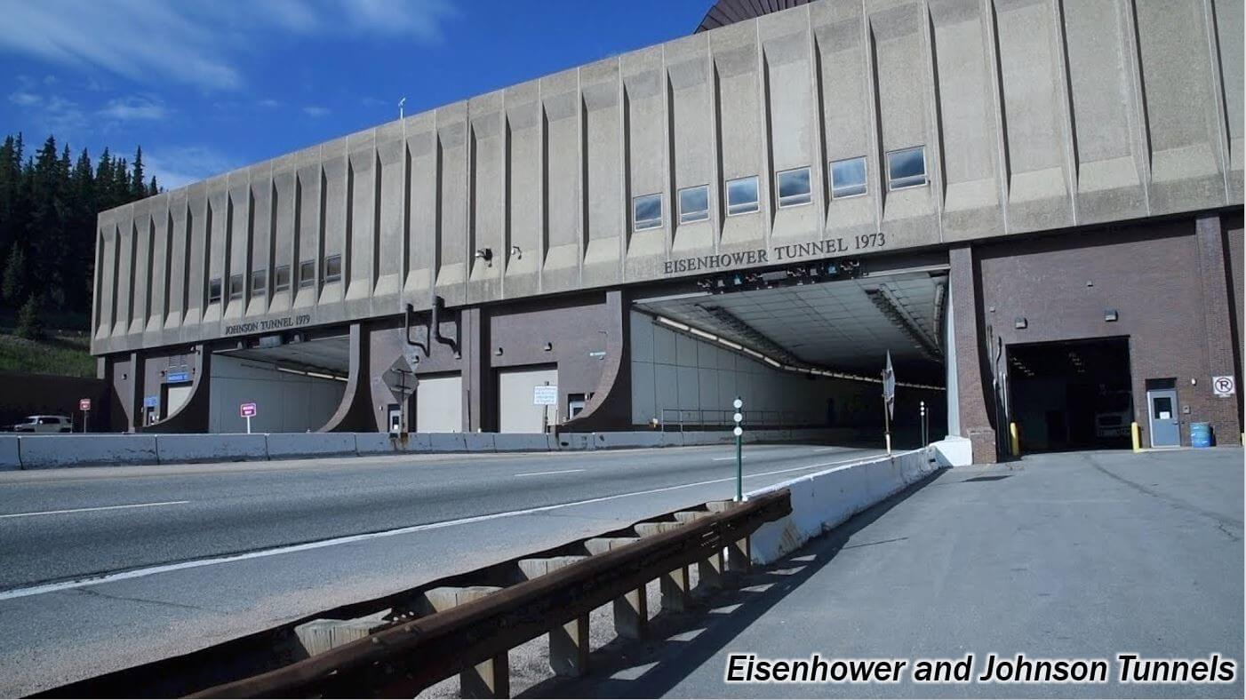
Pre-NEPA Highway Design
Construction on the Eisenhower Tunnel at Loveland Pass (the highest vehicular tunnel in the world!) began in 1969, prior to NEPA. Construction on the first tunnel bore was completed in 1973 and the second was completed in 1979.
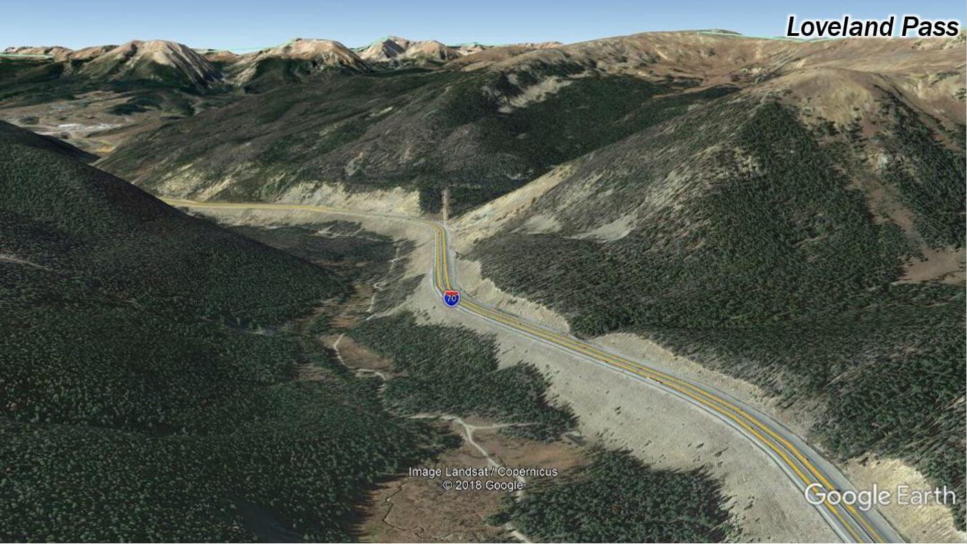
As you drive through the tunnel and the approaches on either side, it’s quite clear the site was designed with one thing in mind — getting cars from point A to point B as quickly as possible. This was the goal of the project, but when other goals aren’t considered, something can get lost, opportunities can be missed. In this instance the design looks like someone came up with a magic cross section and profile slope and off they went ramming a template through the existing topography. (See image below.)
As you can see, there are major cuts and fills everywhere with the road slashing across the slope with very little regard to the land, and almost no consideration for anything except getting cars from A to B. The project design team was mostly comprised of engineers, and the result is quite visibly pre-NEPA — as it paid very little regard to environmental values. Notice on this image how, from above, the road looks like an actual scar on the landscape, clearly working against the terrain instead of with it.
Post-NEPA Highway Design
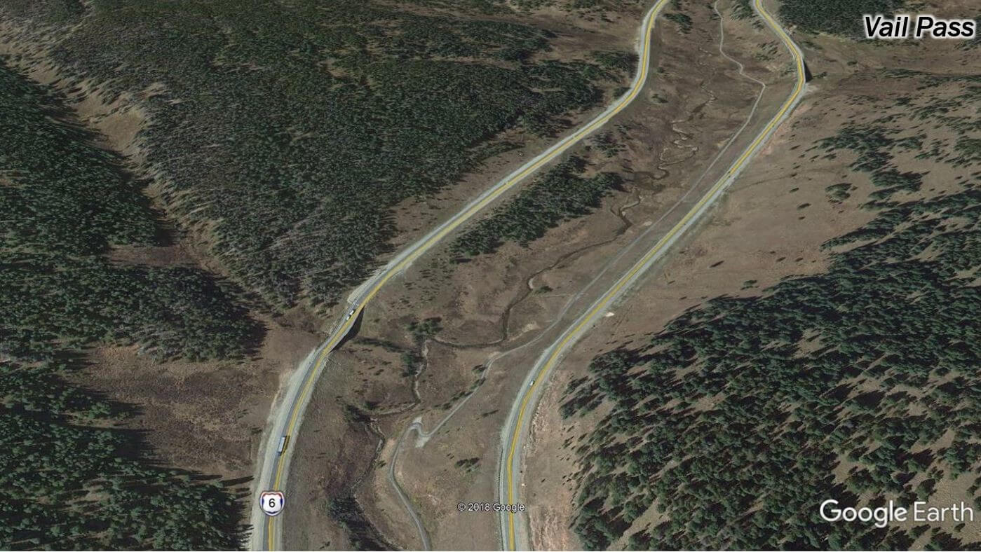
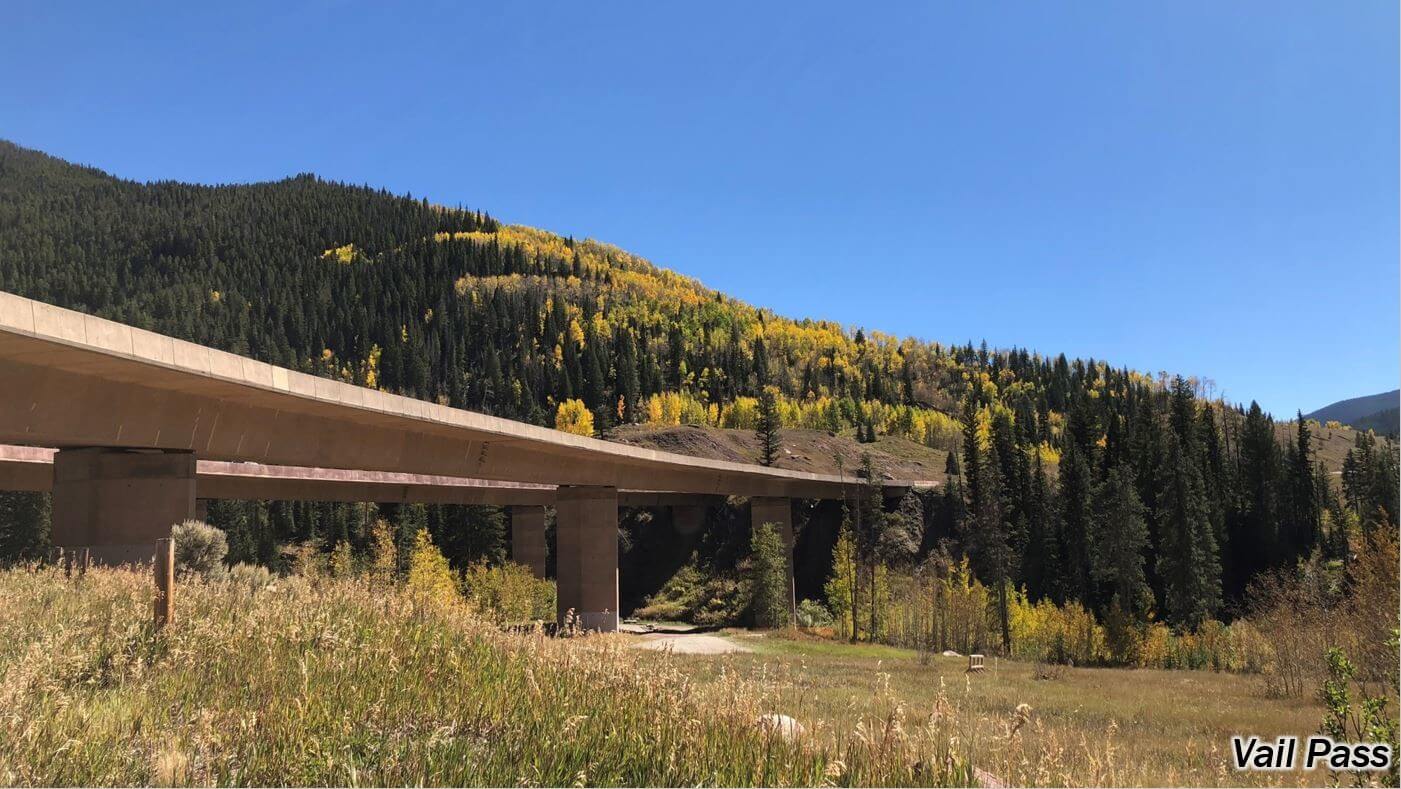
Drive a bit further west and you arrive at Vail Pass, which was designed after NEPA was implemented and the public and local governments were greatly involved with the project. Variables beyond just the engineering goals entered the decision-making process, such as community health and the environment. Because of that, much more thought went into how the road was laid across the land to minimize impacts, and more effort was put into restoring disturbed areas.
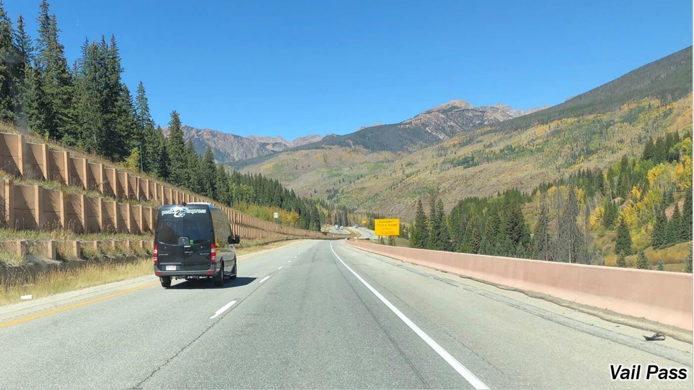
To minimize cut and fill slopes, the east and west lanes diverge in places by several hundred feet and retaining walls were used. (See image below.)
Notice how close mature trees are to the highway in the photo below. You can’t see it, but the east bound lanes are up on top of that wall on the left.
Viaducts were an important part of this detailed design and were constructed to span sensitive areas and allow for wildlife movement underneath them, like in the photo below.
Another design approach on Vail Pass was the construction of a recreation trail, which was a new element influenced by public involvement.
The project included multiple goals — not only getting cars from point A to point B —but also the recreation and environment gains.
Landscape architects, wildlife biologists, archaeologists (an important site was discovered and excavated prior to construction), and restoration ecologists were part of the multi-discipline design team.
Further Post-NEPA Highway Design
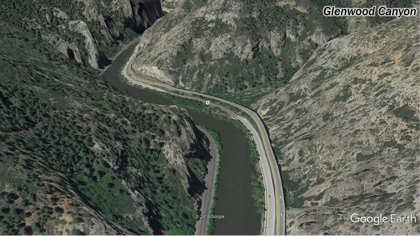
Finally, as we drive further west, we reach Glenwood Canyon, where the highway construction was completed in 1992. What an amazing stretch of highway! The 4-lane version of the road still retains a lot of the character of the historic 2-lane road that clung to the canyon walls.
As you can see above, thanks to NEPA, so many of the trees and shrubs were protected during this development that there is very little scarring visible. You can hardly tell where rock was blasted and removed. This is because, in addition to considering the environmental effects, the natural appearance of the final project was considered. Thanks to the help of a special stain that was developed for areas of rock removal, the freshly exposed rocks were stained to match surrounding rock and help them blend in. This attention to detail speaks to the importance of aesthetics to the project. Additionally, in many areas the roadway was elevated on piers, meaning there was little or no disturbance to the ground, and many existing trees and shrubs were preserved directly under the new highway.
And again, we have integration of recreational features and extensive consideration of the environment. A multi-discipline team was critical — engineering, landscape architecture, wildlife biology, cultural resources, and restoration ecology. The result was one of the most beautiful stretches of highway in the United States built in a way that maximized the potential value of the corridor in as many ways as practical well beyond only moving cars from A to B.
CAN THE EVOLUTION OF ROADWAY DESIGN BE ANALOGOUS TO THE EVOLUTION OF URBAN STREAM DESIGN?
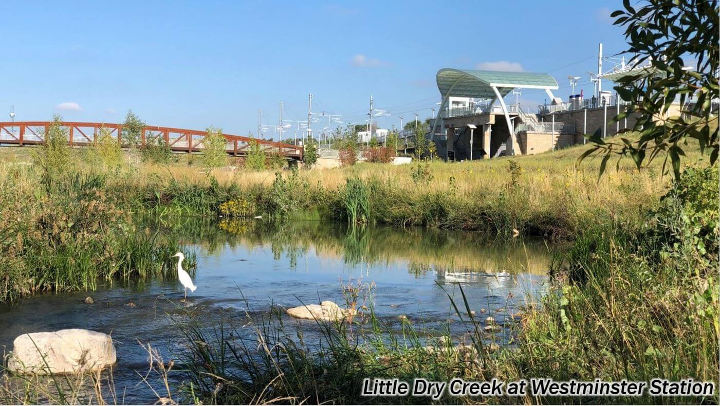
While working on a project along Little Dry Creek at Westminster Station, we thought back to an upstream project on the same creek from the 1990s and how much design had evolved since that time. This also reminded us of what the 1980s vintage channel was like even farther upstream, and how much THAT differed from the 1990s project.
Bam! It occurred to us:
A similar evolution of project design for urban streams had occurred over time as with roadways, with the same positive influence from environmental regulations.
In this case, rather than NEPA, it was Section 404 of the Clean Water Act.
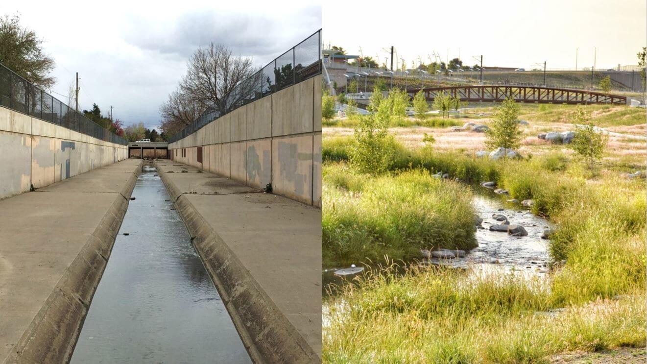
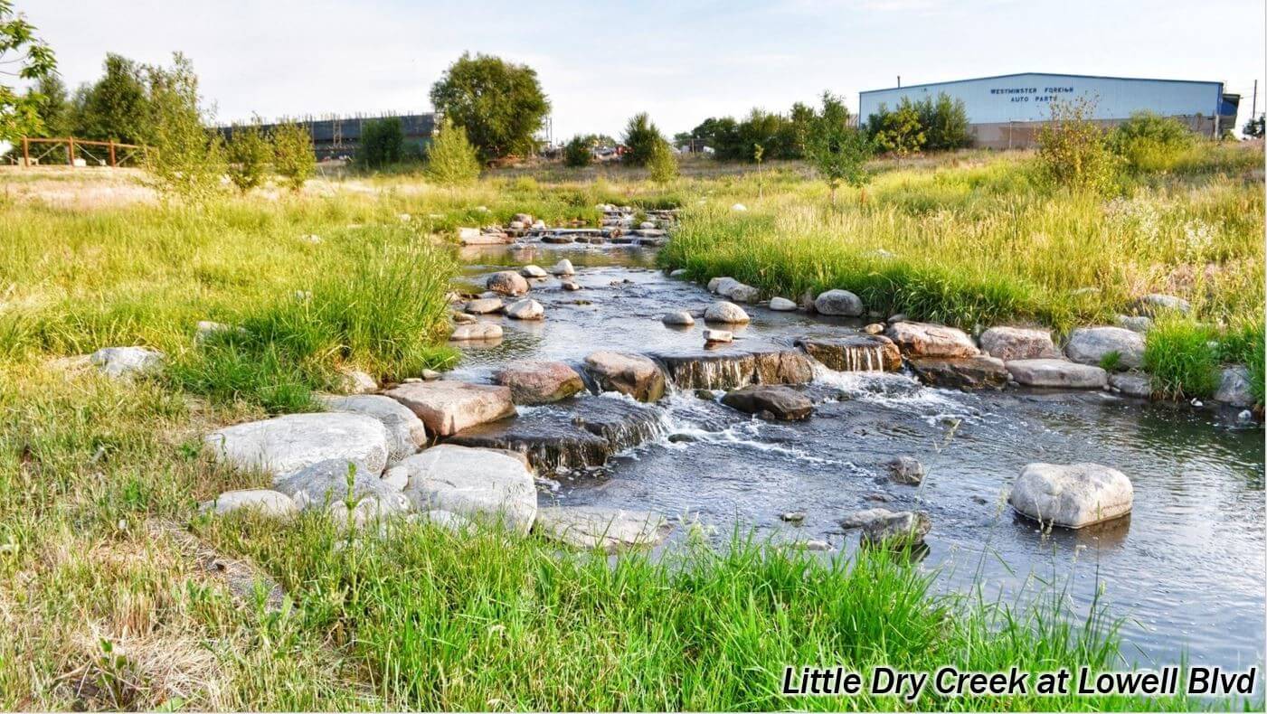
The photos below were taken just one mile apart along Little Dry Creek on the same day, illustrating the stark contrast in urban stream design from the 1980s to today.
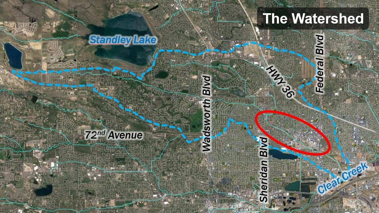
THE WATERSHED
The Little Dry Creek watershed is located in an older neighborhood, at the inner northwest part of the Denver metro and includes parts of Arvada, Westminster, and Adams County. It’s a big watershed, and as you look at the aerial, you’ll see that it’s very built out and has been for quite some time.
Watershed planning is a big part of Mile High Flood District’s goals and in this instance, our area of focus is toward the downstream end, between Sheridan and Federal Boulevards. This is a highly urbanized neighborhood, and when it originally developed there was no real accommodation for flood control, stormwater management, or water quality. In most places, development goes right up to the edge of the very narrow drainageway corridor. These upper reaches of the creek are representative of how urban development happened back in the ‘70s and ‘80s, which is also around the time we developed our Flood Warning Program.
PRE-ENVIRONMENTAL MITIGATION DESIGN
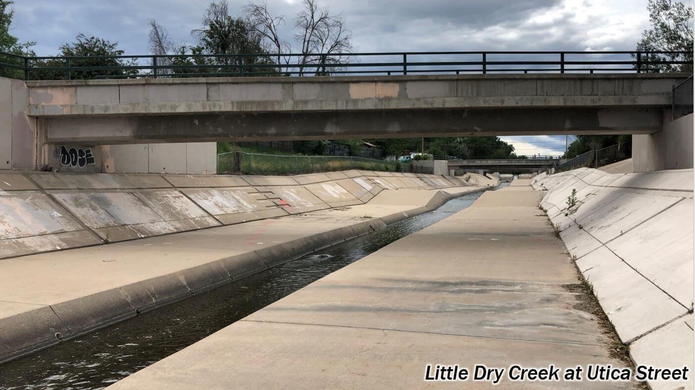
The first parallel we see with I-70 is what goals the older flood control projects focused on. The older projects were all about moving water (rather than cars) from point A to point B. Find the magic cross section and profile slope and plow a template through the topography, with no consideration for how it fits in with the land or environment, or its effects on water quality, the community, and overall human health. The historic pattern of land development left so little room for the creek there really was no other choice for conveying flood water.
These early projects were master planned and designed in the late 1970s to early ‘80s, which is early in the Section 404 history. The first 404 permits were issued in 1977, so there were no real requirements or guidelines yet for consideration of the environment (and no regulatory enforcement of them) meaning it was acceptable to completely eliminate anything natural about the stream corridor.
As a result, the older designs often lined every surface of the stream with concrete. Why? Because it’s very efficient at moving water.
If flood conveyance is the only variable being considered, the design in the photo below works quite well.
POST-ENVIRONMENTAL MITIGATION DESIGN
As time went by, federal agencies such as the Army Corps of Engineers (Corps) and the Environmental Protection Agency (EPA), began to issue guidance on how projects were evaluated under Section 404. In 1990, they started focusing on mitigation, including having upland buffers adjacent to streams and on putting back wetlands that were impacted. But still no focus on stream bed mitigation.
As the Corps pushed engineers to move away from concrete trapezoidal channels, grouted boulder edging was often used.
After that, the Corps eventually started asking for no grout, just dry stacked boulders. In doing so, the boulders got REALLY big to satisfy the engineers’ desire for a factor of safety. Eventually, the Corps began to say no to the boulder edging at all and asked for a more natural material along the water’s edge.
Little by little, the Corps began to require mitigation be incorporated into channel design in order to get a permit. A big example early on was “bio-engineering” — but what does that mean? To find out, Mile High Flood District did a pilot study on Clear Creek. Initially it was a series of soil riprap weirs with little sprigs of willows stuck into the riprap. The pilot study had mixed success, but suddenly, lots of projects had riprap with willow staking.
For engineers at the time, this was pretty “out there”. Wouldn’t the roots deform the riprap? Would flows just rip everything out? They worried about the design not being locked into place. Roots instead of grout, would that even work? Riprap assuaged the fear of instability from design engineers, and the willow stakes provided the natural material the Corps was looking for, but problems could still develop.
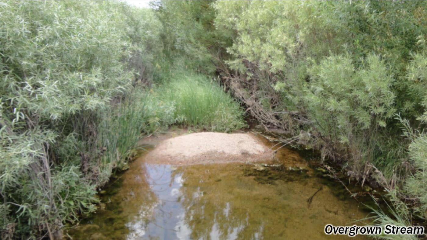
For example, so many willows would get planted that a monoculture could overgrow the creek bottom and actually increase flood risk (see photo below).
In large open spaces there tended to be enough room to allow for this, but in high-risk urban areas with confined stream corridors the increase in flood risk from overgrown vegetation was a problem.
But still, adding willow stakes to riprap was a small step towards making engineers more comfortable with designs that relied less on traditional hardened structural features and more on vegetation for stability.
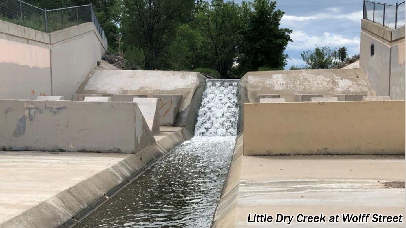
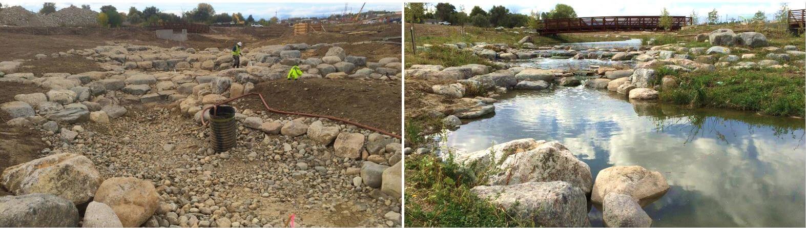
Then the Corps started requiring that vertical drops along the creek bottom be limited to one foot or less, to improve passage for aquatic organisms. This led to a migration away from large sheet pile or concrete drop structures, that historically could be up to 10 feet high like in the photo below.
This change led to shorter sloping grouted boulder structures like in the following photo.
FURTHER POST-ENVIRONMENTAL MITIGATION DESIGN
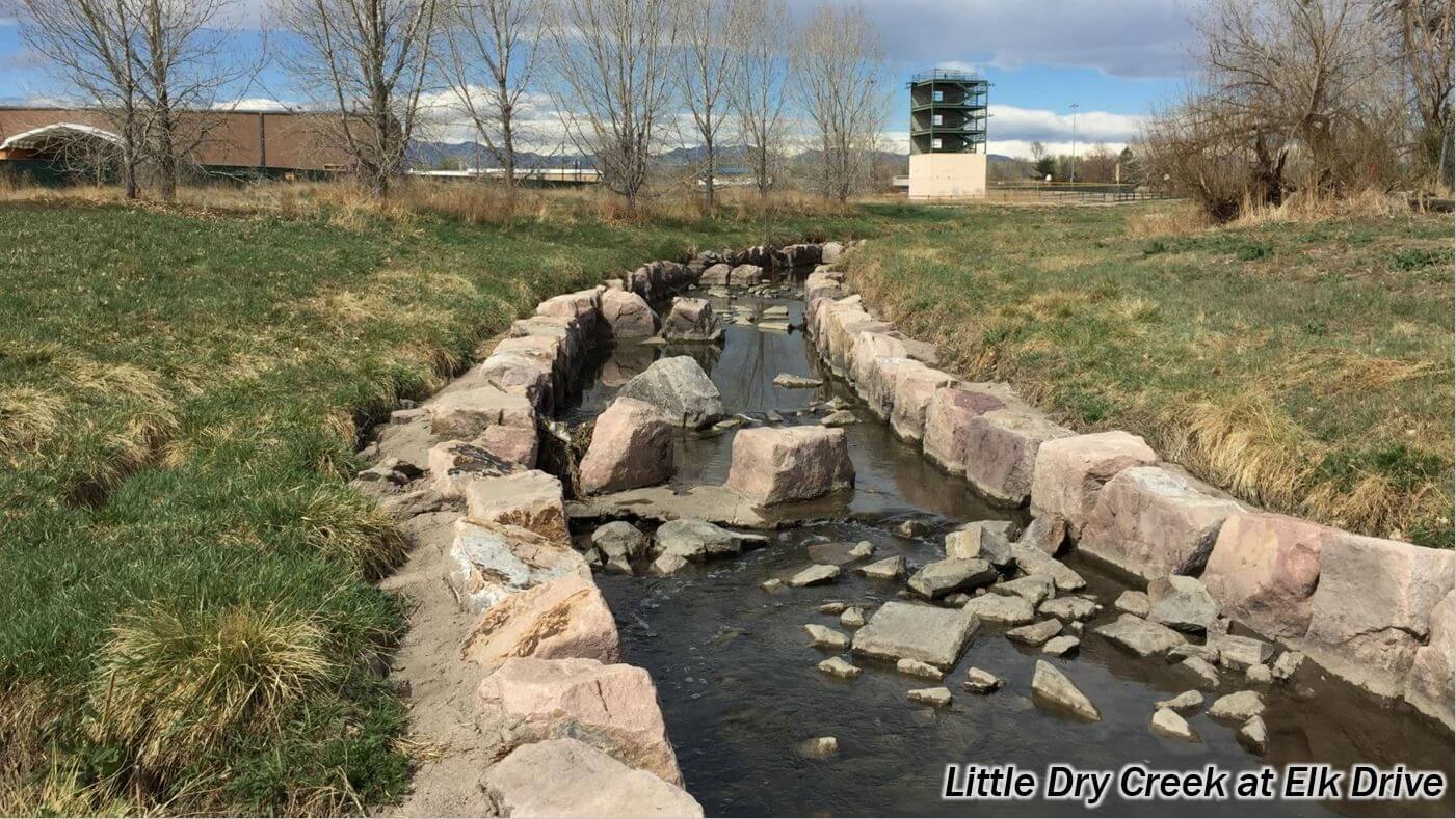
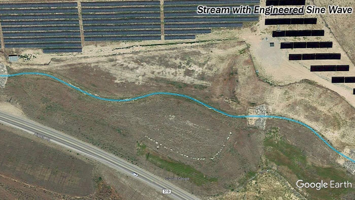
In 2008, the Corps and the EPA issued new mitigation guidance — which focused on the functions and values of the aquatic ecosystem and replacing those as closely as possible in channel designs. There was a big push to maintain the length of stream, meaning a project must result in the same linear feet or sinuosity along the stream as before the project. There would be no more straightening and shortening of channels to move the water through quickly from A to B.
As engineers grappled with this new requirement, it resulted in channel alignments with perfect sine waves that had fixed wavelengths and amplitudes, like in the photo below.
This was more natural looking than previous stream designs, but a little too geometrically perfect to truly mimic what would be seen in nature.
The result of all these incremental requests by the Corps was to get engineers to come up with creative solutions, which led to changes in stream channel design practices and floodplain management.
Designs were pushed away from the single focus of moving water from A to B (which forced a fixed single objective solution onto the landscape), toward having multiple project goals and multi-discipline teams.
More and more nuances were being added, more variables being considered, and more value was being created as a result. Flood conveyance was still being achieved, and additional valuable community objectives were being met along with it.
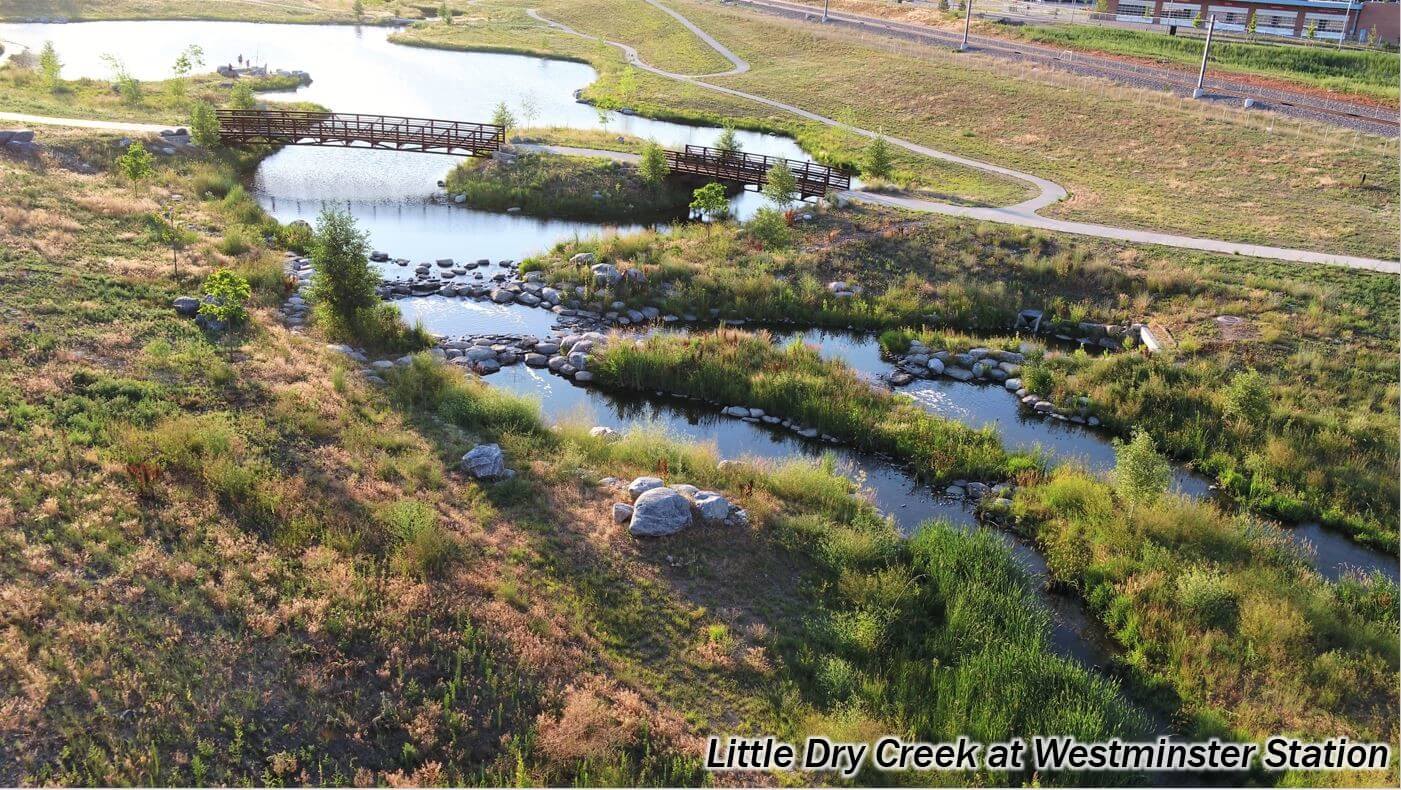
The Little Dry Creek at Westminster Station project represents the culmination of this channel design evolution — analogous to the Glenwood Canyon section of I-70. It fully incorporates flood and stormwater management, along with environmental and public interests, into the cost-effective project design. The vegetation isn’t just dressing over structural materials, the vegetation IS the structural material in many places, meaning we have fewer of the costly structural features common in older designs.
An extensive amount of riprap was still used in places on the project, but rather than simply plugging the riprap with willow stakes, a diverse plant palette of grasses, shrubs, and trees were planted to both stabilize the stream channel and create biodiversity.
The design exemplifies working with the inherent character of natural systems, rather than forcing a fixed single objective solution into a setting. While there definitely are fixed points and guidance, the design allows the water and system to behave naturally as much as possible.
It makes sense that within the context of meeting project specific stormwater management goals:
The end result of letting streams be more natural is a much more robust and productive system.
A system able to put the water to much more productive use supporting a functional aquatic ecosystem, rather than moving it through as quickly as possible.
CONCLUSIONS
What have we learned from all of this?
Regulations keep evolving and influencing project designs. And, generally speaking, the regulatory push has helped produce better outcomes that meet more goals, and engineers have embraced the challenge. It can certainly be argued what the most effective level of regulation should be, but it’s hard to argue with the positive results these example projects have illustrated. At the very least, the regulations have forced more inclusive decision-making processes, which has helped produce linear infrastructure that provides multiple benefits to the community and to the environment.
Circling back to I-70 and the evolution of environmentally sensitive highway design, there are many questions that arise when thinking about the further technological developments that may occur. For example: What future strides will transportation design take? Certainly, driverless cars will affect our systems, but what if engineers take it even further? What if cars didn’t even need roads? What if they all flew, like in The Jetson’s cartoon or the Back to the Future movie?
Is there someplace similar stream designs can go? What if we went into the watershed and created enough runoff reduction to create hydrology that actually mimics natural pre-development hydrology? Not just in peak flows, but also in the volume, duration, frequency, and seasonality of flow reaching the stream? In that case, there would no longer be a need for stream restoration and flood control projects like Little Dry Creek at Westminster Station.
As with all things in life, it’s interesting to speculate on what will happen in the coming decades due to the advancement of technology. But thanks to the work that Mile High Flood District does to keep pace with those developments, we’re certain we’ll be able to continue to create the most economical and environmentally sound projects for many years to come. To learn more about what criteria and guidance Mile High Flood District creates for engineers, planners, landscape architects, developers, contractors, and the general community in these areas, check out our latest Urban Storm Drainage Criteria Manual.
This website uses cookies so that we can provide you with the best user experience possible. Cookie information is stored in your browser and performs functions such as recognising you when you return to our website and helping our team to understand which sections of the website you find most interesting and useful.
Strictly Necessary Cookies
Strictly Necessary Cookie should be enabled at all times so that we can save your preferences for cookie settings.
If you disable this cookie, we will not be able to save your preferences. This means that every time you visit this website you will need to enable or disable cookies again.
3rd Party Cookies
This website uses Google Analytics to collect anonymous information such as the number of visitors to the site, and the most popular pages.
Keeping this cookie enabled helps us to improve our website.
Please enable Strictly Necessary Cookies first so that we can save your preferences!