
City Park Channel FHAD
Background
Loewen Engineering, Inc. completed this Flood Hazard Area Delineation (FHAD) for MHFD and the City & County of Broomfield provide an up-to-date analysis of the existing floodplain along City Park Channel and City Park Channel South Tributary. This up-to-date analysis will assist project stakeholders and other users in implement floodplain zoning ordinances, floodplain regulations, and other land use oversight, as needed, to manage and reduce potential damages to and development in the floodplain.
Project Area Map
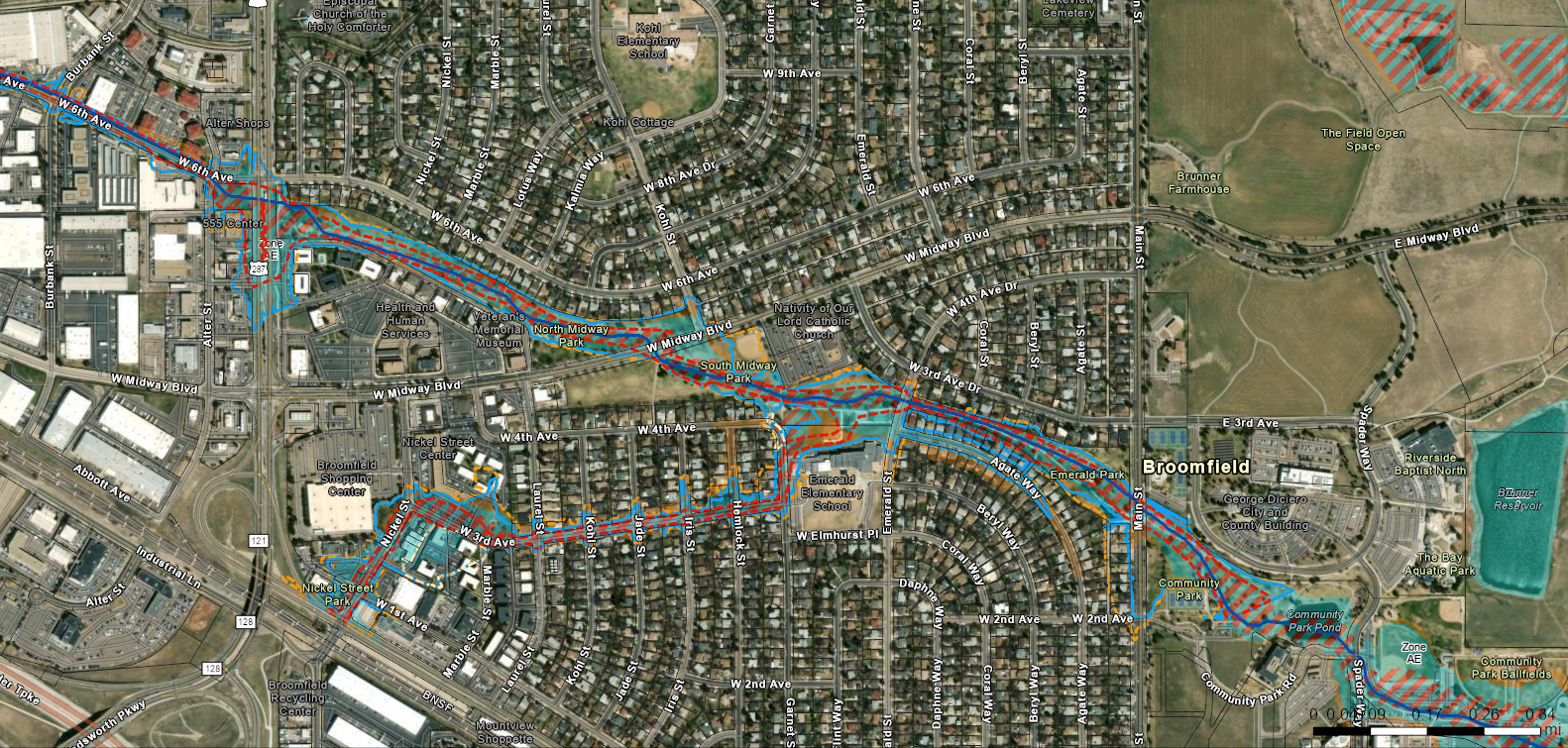
Interactive Map
Click here to view the full interactive map in a new window
Public Meeting
Thursday, April 13, 2023
5:00pm to 7:00pm
Lakeshore Meeting Room, Broomfield Community Center
280 Spader Way
Broomfield, CO 80020
Channel Improvements Project
MHFD and Broomfield have partnered to design improvements for City Park Channel to manage the flooding risk in this mapping and in order to improve the health of the channel. More information about that project is available at the project page on Broomfield Voice here: https://www.broomfieldvoice.com/flood-district-outreach-project.
Contact
Project Members
City & County of Broomfield
Rebecca Baker, rbaker@broomfield.org
MHFD
Brooke Seymour, bseymour@mhfd.org
Dan Hill, dhill@mhfd.org