
History
Major Milestones of Colorado’s Front Range watershed history
Take a look back at the history of Mile High Flood District, from its inception in 1969 as a response to the 1965 Platte River Flood, until present day.
1965
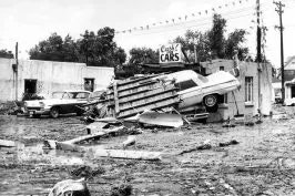
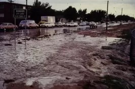
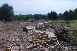
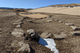
The South Platte River flood of 1965 was Denver’s worst flood of record. It resulted in property losses of about $300 million in Denver alone and over $500 million in the South Platte Basin. Learn More.

1968
National Flood Insurance Act passes. This legislation led to the creation of the National Flood Insurance Program, providing availability to flood insurance and incentivizing best practices in floodplain management.

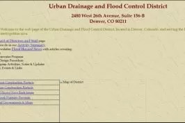
1969
Senator Shoemaker introduces legislation in the Senate to form the Urban Drainage and Flood Control District, it passes 26 to 7. It also passed the house, 49 to 14. The District began operation with two staff and funding of 1/10 mill.
1970
The District adopts regions first floodplain regulations, predating the National Flood Insurance Act.

1971
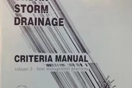
The District assumes responsibility for the Urban Storm Drainage Criteria Manual from DRCOG.
1971
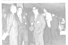
The District holds the first Syposium, a two-day event held at the Regency Rodeway Inn Denver with the theme “Urban Drainage in a Regional Context”.
1972
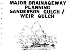
The District’s first masterplans are published for Weir and Sanderson Gulch. City and County of Denver and the City of Lakewood were partners in these efforts.

1972
L. Scott Tucker was selected as Executive Director.

1973
State legislature approved a District Mill levy increase from 1/10 to 5/10 mill (1/10 for Operations and Planning, 4/10 for Construction).
1973
The Flood Disaster Protection Act of 1973 made the purchase of flood insurance mandatory for the protection of property located in Special Flood Hazard Areas
1973
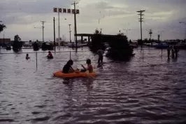
On May 6, record flooding occured along the South Platte River through Adams County making the 1965 flood the second largest event for that reach of river.
1974
The District starts a Floodplain Management Program in response to increased instances of damaging floods in the region.
1976
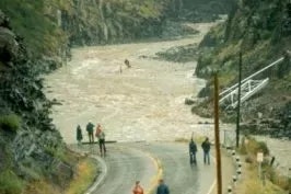
Big Thompson Canyon Flash Flood occurs on July 31 during Colorado’s Centennial celebration causing massive damage totaling over $35 million and claiming over 140 lives.
1978
The District develops a first ever “Flood Disaster Plan” to define roles and responsibilities and tasks during and after a crisis.

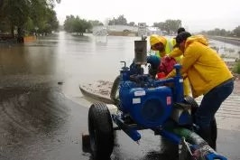
1979
The District starts the Flood Warning Program providing early warnings of potential and imminent treats to local governments.
1979
The District embarked upon the task of developing a maintenance program after a temporary 4/10 mill levy that would encompass only the “major” portions of some streams passes in the legislature.
1980
The District receives a “Friends of the River” award from the Greenway foundation for its involvement in the redevelopment of the area.

1981
The Maintenance Eligibility Program (MEP) officially begins providing incentives for local governments to require District approval for development projects proposed near streams.
1987
The District requested and received a funding increase of 0.1 mill for a South Platte River program.
1991

1992
1995
1996
1997
1999

2003
It’s a busy time at the District as a 40-year low in mortgage rates is causing a rapid development expansion along the front range with the growth expected to continue for several years to come.
2003
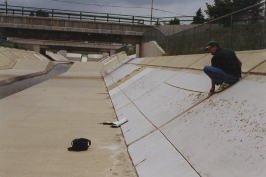
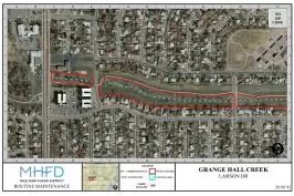
The District begins using GIS for the routine maintenance program, moving away from the standard library of aerial images that were previously used.

2004
Dave Lloyd becomes Executive Director

2006
Staff from two different groups merged to form the Design, Construction, and Maintenance Program.

2007
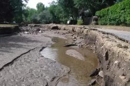
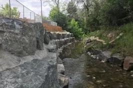
On May 14, a storm claimed the life of 2-year-old Jose Matthew Jauregui Jr., swept away from his mother by a fast rising Lakewood Gulch. Five years later the District and Denver finished removing the walled section of this reach. Learn More

2008
Paul Hindman becomes Executive Director.

2009
The District undertook the massive task of migrating the majority of the printed materials (OSPs, Masterplans, As-builts) to the website.
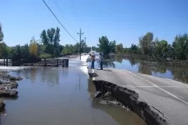
2013
September floods cause widespread damage to many areas of the District due to rainfall that exceeded the 500-year event in places.
2013
After pitching the idea of a State-wide stormwater education program to CSU, the District secured a grant to help start the Colorado Stormwater Center.

2015
The District led a statewide charge in 2015 to successfully pass legislation that changed Colorado water law, declaring that stormwater detention facilities overseen by government entities do not materially injure water rights.

2016
Ken Mackenzie becomes Executive Director.

2017
The District holds the first Stream Management Academy bringing a diverse group of professionals together to strengthen collaboration on watershed and stream projects.
2017
The Master Planning and Floodplain Programs are consolidated to form “Watershed Services”
2017
The District creates a Development Services Enterprise, allowing land developers to voluntarily partner with the District to fund and implement stream improvements necessitated by their land development in lieu of going through the District’s traditional maintenance eligibility acceptance program.

2018
Residents of the District pass 7G, a bill removing the District from the restrictions of TABOR. This will nearly double the annual budget over the next two years.
2018
The District restructures the organization by watersheds. This “Watershed Approach” increases the breadth of work for engineering staff and removes the silos of the previous programmatic structure.
2019
The District rebrands as “Mile High Flood District” and develops a new logo just in time for a 50th year celebration!

2019
MHFD creates a dedicated Property Acquisition Fund Reserve. This fund helps local governments purchase at-risk properties in the floodplain and return the land to the stream corridor.

2020
As the COVID-19 pandemic spread throughout the world in mid-March, MHFD closed the office and the staff of over 50 worked from home for the remainer of 2020 and into 2021.

2022
Laura Kroeger becomes Executive Director.

2023
First launched MHFD Confluence, MHFD’s online data communications and management platform for local government Work Requests and development of the 2023 Work Plan.
2023
MHFD moved into a newly renovated office building in a new location – 12575 Bayaud Avenue, Lakewood, Colorado