
New History Page
1960's
1965
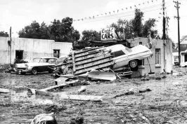
The South Platte River flood of 1965 was Denver’s worst flood of record. It resulted in property losses of about $300 million in Denver alone and over $500 million in the South Platte Basin. Learn More.

1968
National Flood Insurance Act passes. This legislation led to the creation of the National Flood Insurance Program, providing availability to flood insurance and incentivizing best practices in floodplain management.
1970's

1970
The District adopts regions first floodplain regulations, predating the National Flood Insurance Act.

1971
The District assumes responsibility for the Urban Storm Drainage Criteria Manual from DRCOG.
1971
The District holds the first Syposium, a two-day event held at the Regency Rodeway Inn Denver with the theme “Urban Drainage in a Regional Context”.
1972
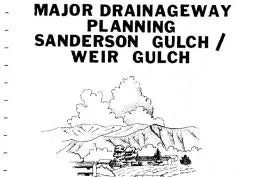
The District’s first masterplans are published for Weir and Sanderson Gulch. City and County of Denver and the City of Lakewood were partners in these efforts.

1972
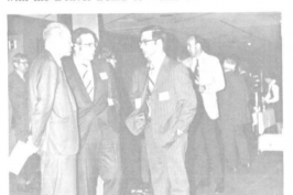
L. Scott Tucker was selected as Executive Director.

1973
State legislature approved a District Mill levy increase from 1/10 to 5/10 mill (1/10 for Operations and Planning, 4/10 for Construction).