8-Floodplain Study Revision Comparison
You can also view changes to the flood hazard mapping with this link:


Virtual Open houses were held August 12th and 13th for Portions of Centennial and Unincorporated Arapahoe County
For a copy of the Open House presentation, click here
You can also view changes to the flood hazard mapping with this link:

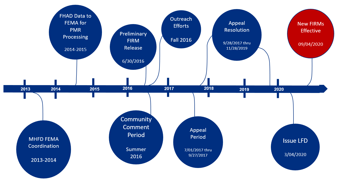
From 2013 to 2014, Mile High Flood District (MHFD) and Federal Emergency Management Agency (FEMA) began a cooperative effort to get a number of locally developed Flood Hazard Area Delineation (FHAD) studies incorporated into the FEMA Flood Insurance Rate Maps (FIRMs). A Risk Mapping Assessment and Planning (Risk MAP) project that used the Physical Map Revision (PMR) process would revise the FIRMs. The FHADs had been produced to identify and update flood risk potential and floodplain boundaries.
The 8-Floodplain Study region consists of eight drainage basins that include the following streams:
Getting the FHAD information on the FIRMs help residents and business owners make informed decisions about personal safety and protecting financial assets. Having current flood mapping also allows community planners, local officials, engineers, builders and others to make determinations about where and how new structures, subdivisions, developments, and redevelopments should be built to reduce risk of flood damage.
Flood risk information that will become effective September 4, 2020 (09/04/2020) are available under the “Pending Products” from the FEMA Map Service Center. Use the “Search All Products” option to filter information for your Community by State, County, and Community. If you are having trouble finding “Pending Products” information click here for more detailed instructions.
How flood map changes may affect your property and insurance requirements.
Flood Insurance for Renters Fact Sheet.
What to ask your insurance agent.
One Page Flood Risk and Flood Insurance Basics.
Guide to options for structures with increased risk.
Flood Risk Mapping Process within Mile High Flood District.
Local Floodplains to Flood Insurance Rate Maps within Mile High Flood District.
Process to determine if a building is in a lower flood risk area.
Differences between a map revision and an appeal of flood map changes.
Your community Floodplain Administrator is the best source of information about flood risk.
Arapahoe County
Mr. Chuck Haskins
chaskins@arapahoegov.com
720-874-6500
City of Aurora
Mr. Craig Perl
cperl@auroragov.org
303-739-7300
City of Centennial
Ms. Stacey Thompson
sthompson@semswa.org
303-858-8844
City and County of Denver
Mr. Jeremy Hamer
jeremy.hamer@denvergov.org
720-913-0720
Douglas County
Ms. Janet Herman
jherman@douglas.co.us
303-660-7490
City of Glendale
Mr. Josh Bertrand
jbertrand@glendale.co.us
303-639-4500
City of Littleton
Ms. Carolyn Roan
croan@littletongov.org
303-795-3836
City of Lone Tree
Mr. Jacob James
jacob.james@cityoflonetree.com
303-662-8112
Town of Parker
Michael Grabczyk
mgrabczyk@parkeronline.org
303-805-3209