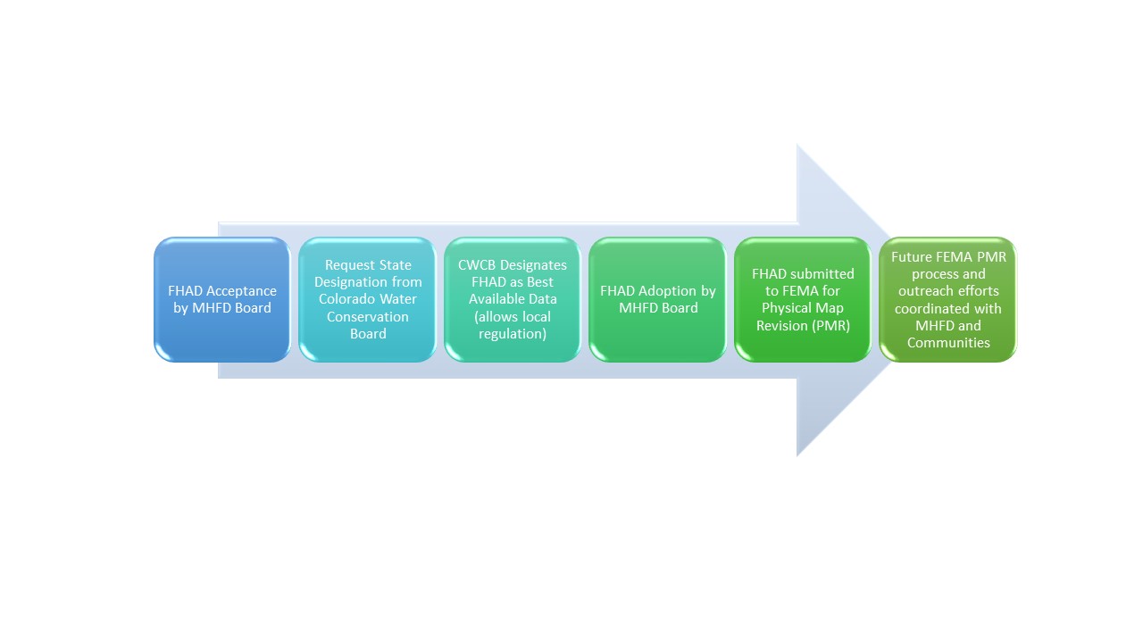
Getting the Flood Hazard Area Delineation (FHAD) information on the Flood Insurance Rate Maps (FIRMs) helps residents and business owners make informed decisions about personal safety and protecting financial assets. Having current flood mapping also allows community planners, local officials, engineers, builders and others to make determinations about where and how new structures, subdivisions, developments, and redevelopments should be built to reduce risk of flood damage.

Flood Hazard Area Delineation (FHAD) to Physical Map Revision (PMR) Process


Have more questions?

Your community Floodplain Administrator is the best source of information about flood risk.

Douglas County
Janet Herman
jherman@douglas.co.us
303-660-7490

Town of Parker
Michael Grabczyk
mgrabczyk@parkeronline.org
303-805-3209

Back to Top

mainstage-mask2