Future Jefferson County PMR

Getting the Flood Hazard Area Delineation (FHAD) information on the Flood Insurance Rate Maps (FIRMs) helps residents and business owners make informed decisions about personal safety and protecting financial assets. Having current flood mapping also allows community planners, local officials, engineers, builders and others to make determinations about where and how new structures, subdivisions, developments, and redevelopments should be built to reduce risk of flood damage.

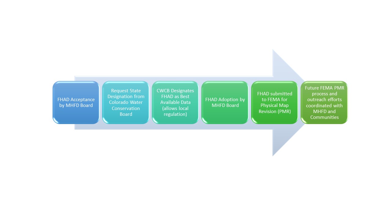
Flood Hazard Area Delineation (FHAD) to Physical Map Revision (PMR) Process

Have more questions?

Your community Floodplain Administrator is the best source of information about flood risk.

Jefferson County
Patrick O’Connell
poconnel@co.jefferson.co.us
303-271-8707

City of Arvada
Melanie Walter
mwalter@arvada.org
303-435-4609

City of Golden
Joseph Lammers
jlammers@cityofgolden.net
303-384-8156

City of Lakewood
Keith Hensel
keihen@lakewood.org
303-987-7944

City of Wheat Ridge
Mark Westberg
mwestberg@ci.wheatridge.co.us
303-235-2863

Back to Top

mainstage-mask2