Weir Gulch Flood Hazard Area Delineation

Cómo ver esta página en español (utilizar Chrome)

Background

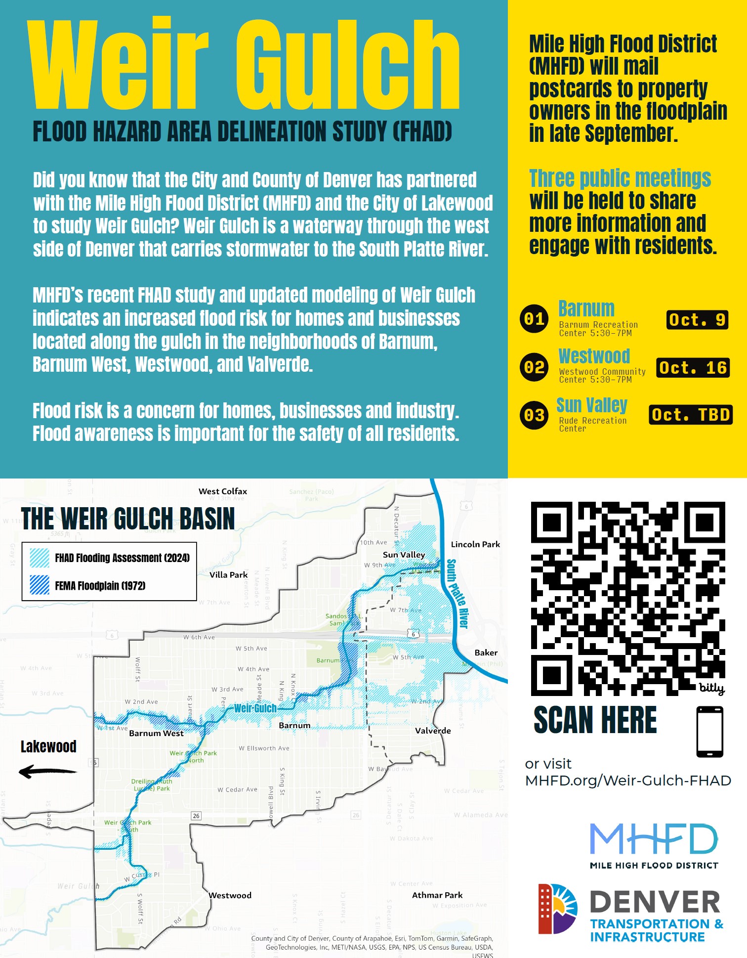
The Mile High Flood District (MHFD) is conducting a Flood Hazard Area Delineation (FHAD) study in cooperation with the City and County of Denver, the City of Lakewood and Jefferson County. The original flood study for Weir Gulch and tributaries was conducted in the 1970s. This new FHAD study offers an up-to-date understanding of flood risk along Weir Gulch, 1st Avenue Tributary, and Dakota Avenue Tributary based on current data and modern technology. The results of this study will allow residents and local authorities to make informed decisions to help protect people, property, and the environment. Flood risk changes over time. The last study of Weir Gulch was done in 1972, and the information from that study is now outdated and does not show the actual flood risk, which is why a new study has been done. Today’s study uses the latest data and technology to better show the current flood risk.

The new FHAD study includes:

  1. Updated ground elevation data
  2. Updated land use information
  3. Updated rainfall data
  4. Modern computer modeling and mapping methods

According to this new study, properties along Weir Gulch are at a higher risk of flooding in the neighborhoods of Barnum, Barnum West, Westwood, and Valverde. Flood risk is a concern for homes, businesses, and industry. Flood awareness is important for the safety of all residents.

Public Meetings

  • Oct. 9th 5:30pm – 7pm at Barnum Rec Center (360 Hooker St, Denver)
  • Oct. 16th 5:30pm – 7pm at Westwood Community Center (1000 S Lowell Blvd, Denver)
  • Oct. 19th 12:00pm 2:30pm at  Rude Rec Center (2855 W Holden Pl, Denver)

Click here to view Wier Gulch FHAD PDF

Project Area Map

Interactive Map

Use the interactive map to see if your property is at risk of flooding. Look under the non-FEMA floodplains for the 100-year floodplain and the Floodway—these show the areas with the most risk for floods

Click here to view the full interactive map in a new window

Project Resources

Contact

Project Members

City & County of Denver

Kim Pirri, Jeremy Hamer or Allison Schaub-DiRosa at  floodplain@denvergov.org

City of Lakewood

Keith Hensel at keihen@lakewood.org

Jefferson County

Patrick O’Connell at poconnel@jeffco.us


MHFD

Christin Shepherd, cshepherd@mhfd.org

Back to Top

mainstage-mask2